Jinmian Mountain Introduction
Jinmian Mountain is located in the Neihu District of Taipei City, the geology of this mountain contains quartz, which makes the top of the mountain sparkle when the sun shines. When viewed from the direction of Bishanyan, the boulders at the top of the mountain look as sharp as a bird’s beak, which is why it is also called Scissors Rock Mountain. When Taipei City was built in the late Qing Dynasty, quartz sandstone from the Neihu and Dazhi Mountain areas was used as the building material, and there are still many traces of excavation left on the mountain.
Popularity
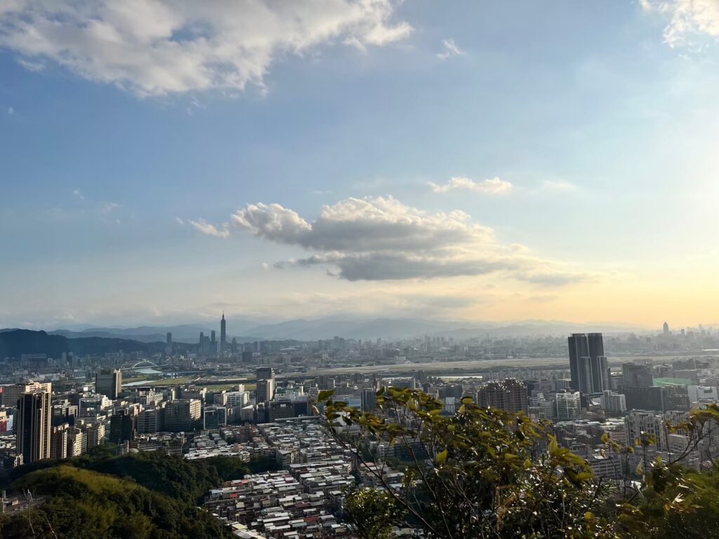
There is a rock-climbing section while you hike this mountain, with steep rock walls but plenty of ropes to hold on to, which is good for cardio training and allows you to experience the fun of different forms of climbing. Climbing to the top provides a 360-degree view of Taipei City, Bihu Park, Bishanyan, and Wuzhishan, and overlooks the Keelung River, Songshan Airport, Miramar Ferris Wheel, and Taipei 101. However, it is recommended to go there on weekdays as there are a lot of hikers on holidays.
Best time to visit Jinmian Mountain
All year round
How to get to Jinmian Mountain Trailhead?
There are three trailheads
– Lane 136, Section 1, Huanshan Rd, Neihu District
MRT: Wenhu Line Xihu Station Exit 1, 10-minute walk.
Bus: Blue 20 shuttle, Blue 27, 214, 256, 268, get off the bus at “TakMing Collage (HuanShan)” stop.
Driving: You can park at the parking lot on Section 1, Huanshan Rd, because there are few parking lots near the trailhead.
– Lane 50, Section 2, Huanshan Rd, Neihu District
MRT: Wenhu Line Gangqian Station Exit 1, 16 minutes walk to Zhuyue Temple.
Bus: Blue 20 shuttle, Blue 27, 268, 256, 214, Red 31, get off at Lishan New Village stop.
– Section 3, Neihu Road, Neihu District
Bus: Take 240 or 247 and get off at the Jinlong Temple stop.
Driving: Parking is available at the nearby Jinlong Temple Parking Lot.
What is the recommended hiking route?
It is recommended to take the o-hike route:
Up the mountain: If you want to experience climbing the rock walls, go up the mountain from the Lane 136 trailhead, you will see two routes, take the one on the right, there will be a sign along the way, go in the direction of “Lunjian Pagoda” or “Big Rock Wall(大岩壁)”, you can experience climbing the rock walls on this route when you reach the Lunjian Pagoda, continue to walk for one minute, then you will see Scissors Rock.
Down the mountain: Follow the sign “Lane 136, Sec. 1, Huanshan Rd.”, then go to “Zhuyue Temple”, and finally you will see “Lane 136, Sec. 1, Huanshan Rd.” and return to the original trailhead.
How long does it take to hike up Jinmian Mountain mountain, difficulty, and length?
The route of Jinmian Mountain is about 3 kilometers, with an elevation of 258 meters and a height difference of about 100 meters. If you are a seasoned climber, you can finish the trail in an hour and a half, but if you are a less experienced hiker, or take pictures along the way, you may need to spend more time on the mountain, so it is about to take 2 to 3 hours.
Scenic spots along the trail
Huashan Pagoda, Chongyang Pagoda, and Lunjian Pagoda.
Jinmian Mountain viewpoints and photos

Overlook Taipei City 
Overlook Taipei City
Any necessary permits or fees
No permit required, free of charge
Hiking tips
If you are concerned about climbing the rock wall with your bare hands, you can bring gloves, and we recommend you tie your shoelaces and wear shoes with good gripping power.

